This section introduces the data types that are required for spatial columns and provides guidelines for choosing what a spatial column's data type should be.
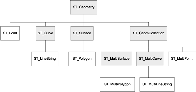
When you enable a database for spatial operations, DB2 Spatial Extender supplies the database with a hierarchy of structured data types. Figure 6 presents this hierarchy. In this figure, the instantiable types have a white background; the uninstantiable types have a shaded background.
Figure 6. Hierarchy of spatial data types. Data types named in white boxes are instantiable. Data types named in shaded boxes are uninstantiable.
|
The hierarchy in Figure 6 includes: